11 UNFORGETTABLE Hikes in Norway
Unforgettable Norway Hikes, best hikes in norway
Very few places in the world have as much varied scenery, unobstructed beauty and hard-core adventure as Norway, and with just 5 weeks to see and hike as much of this stunning country as possible, we gathered our research and hit the trails! Watch episode 9 of our VanLife Europe Part 2 YouTube series below to see us crossing the border from Sweden into Norway + footage from our 4 favorite hikes in the Lofoten Islands!
NOTE: For the sake of geographical orientation, this list has been written in order from North to South, which is also the order in which we hiked them. The map below features the 4 hikes we did in the Lofoten Islands, where our epic Norwegian adventure first began!
best hikes in lofoten, best hikes norway, must do lofoten
Pro Tip: Before we hit the ground running, we want to make sure to mention Kvikk Lunsj, only THE MOST FAMOUS chocolate bar in all of Norway AND the most quintessential thing to eat on any and every Nordic hike!! Read this excellent article to learn why.
galdhopiggen hike, highest peak norway, kvikk lunsj norway
As we said, we wasted no time once we were in Norway, and so on our 3rd day we chose a hike from our “Explore Lofoten” guide book, which looking back, ended up being the most difficult mountain of our entire trip…
vagakallen hike, best hikes norway, best hikes lofoten
1. VÅGAKALLEN (Henningsvaer, Lofoten):
9 hours roundtrip + 7 miles + start at sea level and hike 3,093 ft to the GNARLY summit… or at least try + the trail is NOT well marked (we got lost, twice)
vagakallen hike, best hikes norway, best hikes lofoten
vagakallen hike, best hikes norway, best hikes lofoten
This majestic peak, which is said to resemble the shape of Mt. Everest, as beautiful as it might be, was the hardest, SKETCHIEST hike we have ever attempted. And we say “attempted” because we didn’t actually make it to the very top… which has NEVER happened before, all thanks to “THE ROOFTOP”… be sure to watch our episode for more on this beast. But as freaky as this hike was, it was also one of the most beautiful and rewarding peaks we have ever (almost) made it to the top of:
hikes norway, lofoten norway, vanlife norway
vagakallen hike, best hikes norway, best hikes lofoten
vagakallen hike, best hikes norway, best hikes lofoten
vagakallen hike, best hikes norway, best hikes lofoten
2. VEGGEN (Haukland Beach, Lofoten):
2 hours roundtrip + 1,600 ft elevation gain + not too strenuous + great camping on the beaches below
veggen hike lofoten, best hikes lofoten
veggen hike lofoten, best hikes lofoten
3. RYTEN (Kvalvika Beach, Lofoten):
3.5 hours roundtrip + 5 miles + 1,782 elevation gain + above the magical Kvalvika Beach that can only be accessed via hike (for an added adventure bring your tent and hike to the beach below!)
ryten lofoten, kvalvika beach, best hikes norway
This is also where you can recreate the crazy photo below!
ryten lofoten, kvalvika beach, best hikes norway
BONUS: On your way to Ryten, you get to drive over the famous Fredvang Bridges.
fredvang bridges drone, lofoten bridges, ryten hike
fredvang bridges drone, lofoten bridges, ryten hike
4. REINEBRINGEN (Reine, Lofoten):
2 hours roundtrip + 1 STEEP mile each way + 1,470 ft elevation gain + the trail is rough, NOT good after or during rain
reinebringen hike, best hike lofoten, best hike norway
reinebringen hike, best hike lofoten, best hike norway
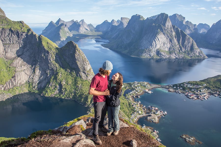
This hike gave us probably the most iconic view in all of Lofoten AND we did it at sunrise, so we had the entire place to ourselves (+ a few campers).
reinebringen hike, best hike lofoten, best hike norway
Pro Tip: Hike at sunrise and bring supplies to make coffee!
After spending 2 weeks in Lofoten we decided it was time to head South to see the rest of the country… it was hard to leave but our list of adventures was long, so down to the National Parks Region we went!
best hikes norway, must do norway, iconic hikes norway
Watch this episode to follow as drive South from Lofoten + see footage from the next 3 hikes on our list!
5. SNØHETTA (Dovrefjell):
4.5 hours roundtrip + 4.5 miles + 2,755 ft elevation gain + WAYYY COLD AND WINDY, literally thought we were gonna get blown off (be sure to check the weather)!
Snøhetta, which literally means “snow cap,” is Norway’s highest mountain outside of Jotunheimen National Park (continue reading for more on those hikes below). We started our excursion by taking the first Dovrefjell National Park shuttle (8:30am) from the Hjerkinnhus Mountain Lodge to the trailhead at Snøheim (+ we were able to shower here at the end of our hike before taking the shuttle back to our van). We arrived to a sunny sky + a perfect view of Snøhetta, she’s the peak with the snowy trail leading to the white tower on the right:
snohetta hike, best hikes norway
With excellent “T” marks and signposts we ascended without any technical difficulty, even with the poor visibility we encountered as we scrambled up the granite boulders and snowfields at the top!
snohetta hike, best hikes norway
snohetta hike, best hikes norway
snohetta hike, best hikes norway
snohetta hike, best hikes norway
Fun Fact: One of most memorable aspects of Dovrefjell, which is also what makes it most famous today, is the Musk Ox. These Arctic beasts, survivors of the last ice age, were reintroduced in Norway in 1932 exclusively in the Dovre Mountains. There are only a handful of places on earth where musk oxen can readily be seen in the wild, and the eastern valleys of Dovrefjell are among the most prime. We happened to see them 6 different times that day! Our best view was from the shuttle bus on our way back that evening:
snohetta hike, best hikes norway
6. BESSEGGEN RIDGE TRAIL (Jotunheimen National Park):
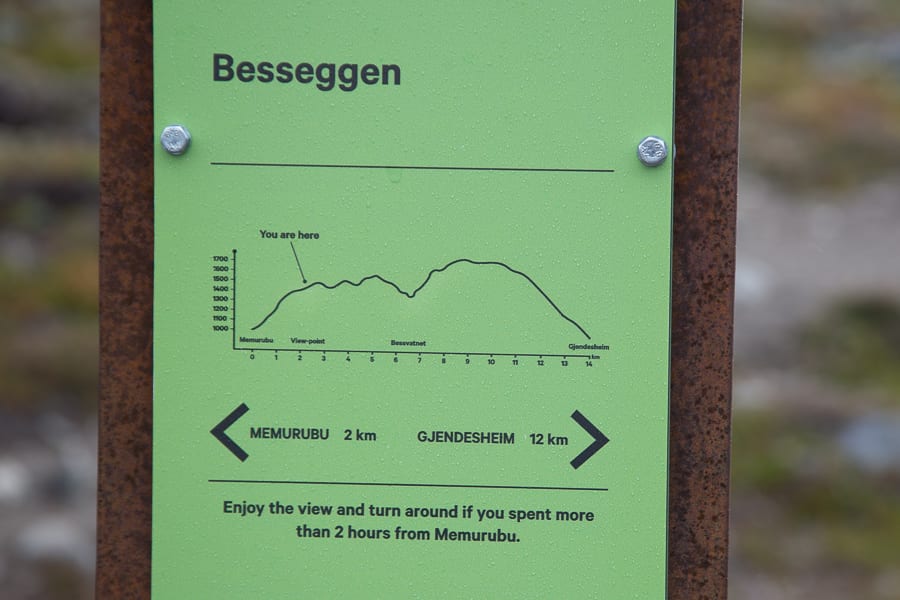
7 hours roundtrip + 8.5 miles + 2,950 ft elevation gain (chart below) + named by NatGeo as one of the best hikes in the world!
It all started by taking the 7:45am ferry from Gjendesheim (where we camped that night before) to Memurubu (where the trailhead starts), and from there the magic unfolded:
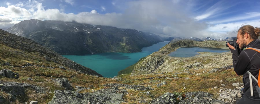
Climbing the famously scenic ridge!
After making it to the highest point on the trail, we were treated to a flat(ish) trail + moon rocks:
7.GALDHØPIGGEN (Jotunheimen):
THE HIGHEST MOUNTAIN IN NORWAY/NORTHERN EUROPE at 8,100 feet! 9 hours roundtrip + 7 miles + 4,600 ft elevation gain!
galdhoppigen, highest peak in norway, best hikes norway
“Jotunheimen” National Park, which translates to “Home of the Giants,” is home to the highest, grandest peaks in Norway. Actually, it wasn’t until recently that Galdhopiggen was recognized as the tallest mountain, the title used to belong to Glittertind (8,087 ft high), until the recent glacial melt caused the peak to loose some inches!
spiterstulen map, norway hike map, galdhopiggen map
This hike was CHALLENGING. At the 3 hour mark, we thought we were just about to reach the top, when we quickly realized we had been climbing a false summit (see photo below)… and the actual summit was still 2 hours away… across LOTS of SNOW!
galdhopiggen hike, highest peak norway, best hikes norway
galdhopiggen hike, highest peak norway, best hikes norway
galdhopiggen hike, highest peak norway, best hikes norway
But once we reached that glorious summit, the view from the “Rooftop of Norway” was 110% WORTH EVERY STEP.
galdhopiggen hike, highest peak norway, best hikes norway
Before we move on to #8 on our list, here’s the next episode from VanLife Europe part 2 that shares our adventures from the last 3 hikes in this post!
8. BRIKSDALBREEN (Jostedalsbreen):
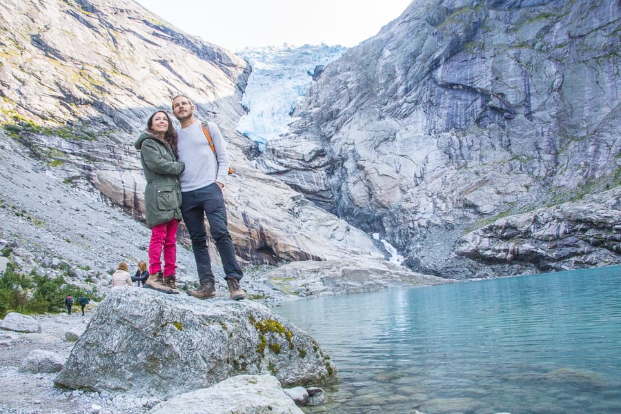
1 hour super easy and enjoyable walk on a paved path = not much of a hike BUT you get to see a mighty “tongue” of THE LARGEST GLACIER IN MAINLAND EUROPE!
jostedalsbreen glacier, briksdalbreen glacier hike, largest glacier in europe, norway hike
jostedalsbreen glacier, briksdalbreen glacier hike, largest glacier in europe, norway hike
Pro Tip: Go early morning to avoid the crowds!
jostedalsbreen glacier, briksdalbreen glacier hike, largest glacier in europe, norway hike
9. PREIKESTOLEN aka. “THE PULPIT” (Lysefjorden):
3 hours roundtrip + 5 miles + 1,082 feet elevation gain = One of the MOST FAMOUS hikes in Norway (see our full post here)
preikestolen drone, norway hikes, vanlife norway
preikestolen drone, norway hikes, vanlife norway
preikestolen drone, norway hikes, vanlife norway
10. KJERAGBOLTEN aka. “CHOCKSTONE” (Lysefjorden):
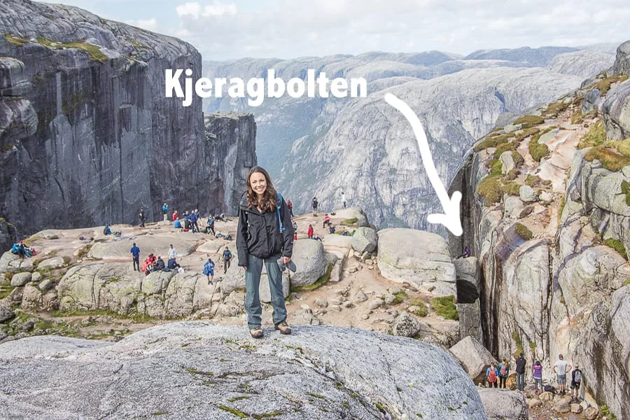
3.5 hours roundtrip + 7 miles + 1,870 feet elevation gain = ONE OF THE MOST ICONIC HIKES IN THE WORLD! (see our full post here)
kjeragbolten hike, chockstone hike, amazing yoga norway hike
This was truly one of the most UNFORGETTABLE hikes of our entire lives.
Kjeragbolten hike, best hikes norway, chockstone hike
11. GAUSTATOPPEN (Rjukan):
4 hours roundtrip + 5 miles + 2,340 feet elevation gain + we parked at Stavsro (details here), but later realized we could have parked up the road for free
gaustatoppen hike, best norway hikes, most beautiful hike in norway
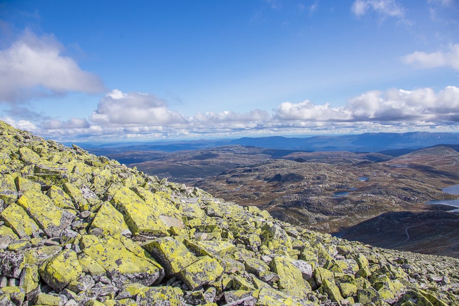
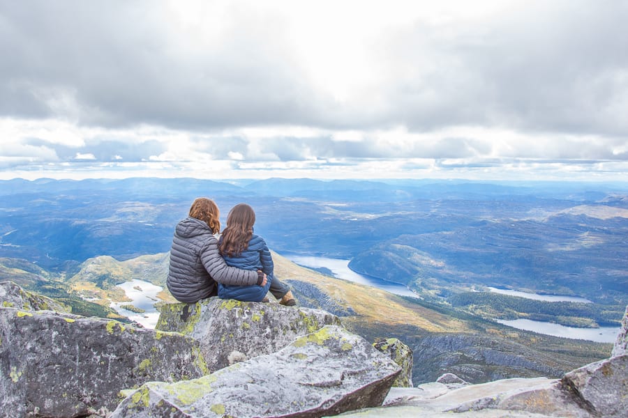
Known as “The Most Beautiful Mountain in Norway,” because of its unusual green rocks, people have been climbing to the top for over 200 years for one of the best views in the country! It is said that on a clear day, you can see one sixth of Norway from the peak!
gaustatoppen hike, best norway hikes, most beautiful hike in norway
This hike was pretty easy until we got to the last bit, known as the “Lion’s Back.” You don’t have to hike this part, but if you want to make to the TRUE peak, then yes, you do + the views and solitude are well worth the challenge:
gaustatoppen hike, best norway hikes, most beautiful hike in norway
gaustatoppen hike, best norway hikes, most beautiful hike in norway
gaustatoppen hike, best norway hikes, most beautiful hike in norway
Just as we were about to make the return trip, the weather did a COMPLETE 360 and it started to SNOW!! If you haven’t already, be sure to watch this episode to see us celebrate our first Norwegian snowfall! You can see it rolling in below:
gaustatoppen hike, best hikes in norway
Now, there were a TON more hikes that we could have done, but with the amount of hiking/driving/exploring that we were doing in such a short amount of time, we truly couldn’t do it all… though we definitely tried our best! Next time we’ll just have to bring two sets of legs 🙂
haukland beach lofoten, amazing norway hikes, honeymoon norway, unforgettable norway
kjeragbolten hike, chockstone hike, amazing norway hike
galdhopiggen hike, highest peak norway, best hikes norway


